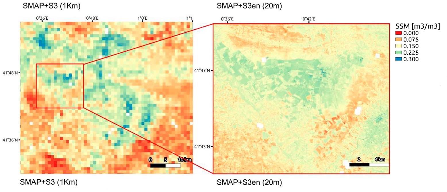
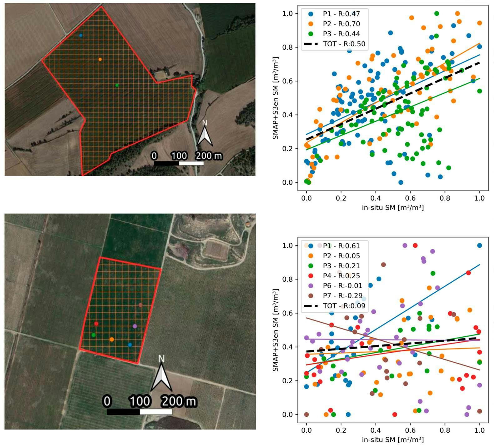
This paper introduces a modified version of the DisPATCh (Disaggregation based on Physical And Theoretical scale Change) algorithm to disaggregate an SMAP surface soil moisture (SSM) product at a 20 m spatial resolution, through the use of sharpened Sentinel-3 land surface temperature (LST) data. Using sharpened LST as a high resolution proxy of SSM is a novel approach that needs to be validated and can be employed in a variety of applications that currently lack in a product with a similar high spatio-temporal resolution. The proposed high resolution SSM product was validated against available in situ data for two different fields, and it was also compared with two coarser DisPATCh products produced, disaggregating SMAP through the use of an LST at 1 km from Sentinel-3 and MODIS. From the correlation between in situ data and disaggregated SSM products, a general improvement was found in terms of Pearson’s correlation coefficient (R) for the proposed high resolution product with respect to the two products at 1 km. For the first field analyzed, R was equal to 0.47 when considering the 20 m product, an improvement compared to the 0.28 and 0.39 for the 1 km products. The improvement was especially noticeable during the summer season, in which it was only possible to successfully capture field-specific irrigation practices at the 20 m resolution. For the second field, R was 0.31 for the 20 m product, also an improvement compared to the 0.21 and 0.23 for the 1 km product. Additionally, the new product was able to depict SSM spatial variability at a sub-field scale and a validation analysis is also proposed at this scale. The main advantage of the proposed product is its very high spatio-temporal resolution, which opens up new opportunities to apply remotely sensed SSM data in disciplines that require fine spatial scales, such as agriculture and water management.
Disaggregation of SMAP Soil Moisture at 20 m Resolution: Validation and Sub-Field Scale Analysis
Giovanni Paolini ¹, Maria Jose Escorihuela ¹, Joaquim Bellvert ², Olivier Merlin ³.
- isardSAT, Parc Tecnològic Barcelona Activa, Carrer de Marie Curie, 8, 08042 Barcelona, Catalunya, Spain.
- Efficient Use of Water in Agriculture Program, Institut de Recerca i Tecnologia Agroalimentàries (IRTA), Fruitcentre, Parc Cientific i Tecnològic Agroalimentari (PCiTAL), 25003 Lleida, Catalunya, Spain.
- Centre d’Études Spatiales de la BIOsphère (CESBIO), University of Toulouse, CNES/CNRS/INRAE/IRD/UPS, 18 Avenue Edouard Belin, 31401 Toulouse, France